
Wind development with the constraints up front
Wind resource, ordinance setbacks, airspace, habitat, and grid access screened together, so fatal flaws surface on day one instead of month nine.
The same project, two timelines
Setbacks, airspace, and habitat surface one at a time over a year of studies. Or all at once in the first hour.
Screen with constraints on
Resource, parcels, ordinance setbacks, airspace, and habitat layers together.
Size the buildable area
Setbacks applied to the parcel. Buildable acreage and turbine count in minutes.
Check the grid
Queue depth and headroom at the nearest POIs.
Advance or drop
Only sites that clear every layer get an option. Next county the same day.
Unlike manual site selection, Basepoint lets you:
One end-to-end platform. Consistent progress, fewer disruptions, faster delivery.
Run automated screening
Resource, setbacks, airspace, habitat, and radar applied together. Only the buildable footprint remains.
Collaborate in one place
Constraint maps, layouts, and the model on one record. No version drift.
Find parcels fast
Owner data across the county, filtered by resource and setback-clear acreage.
Get preliminary layouts
Turbine placements that respect setbacks and spacing, with capacity and energy estimates.
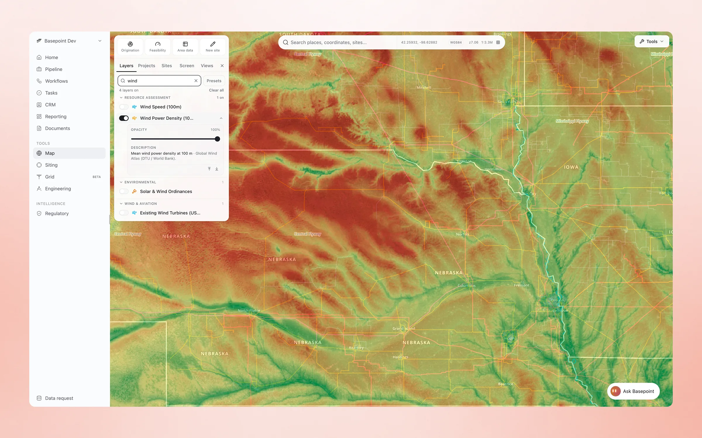
Start from the resource
Wind power density at 100 m, migratory flyways, and county lines on one map before anyone drives out.
Turbines on the actual terrain
Contours, slope, and grading run on the real elevation model, with the turbine placed in 3D where it will stand.

Frequently asked questions
Does Basepoint include wind resource data?
Yes. Wind resource layers sit alongside parcels, transmission, ordinances, airspace, and environmental screening in the site intelligence map.
How does Basepoint handle wind ordinances?
Wind ordinances and moratoria are tracked by jurisdiction with change monitoring, and setback rules feed directly into site screening.
Can Basepoint screen airspace constraints?
Airports and military airspace are included as screening layers so tip-height conflicts surface during prospecting rather than after commitment.
How are habitat and environmental constraints screened?
Federal environmental layers, including wetlands, floodplains, critical habitat, and protected areas, run as screening criteria on every candidate site.
Can we screen transmission access for wind sites?
Transmission lines, substations, and queue activity sit on the same map as the resource and ordinance layers, so grid access is part of the first screen rather than a later study.
Does Basepoint track ordinance changes after land is optioned?
Yes. Ordinance and moratoria changes are monitored by jurisdiction, and watched areas alert you when a rule affecting an active site changes.